Satellite imagery shows how badly the drought is affecting the south of Spain
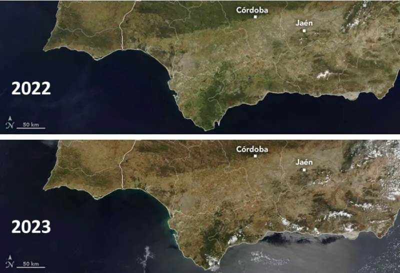
Andalucía's drought crisis can not only be seen from the ground, but also from outer space as highlighted by new images from the Terra satellite released by Nasa, that highlight the worrying situation as we exit the ‘rainy season’ and head towards summer.
The latest images taken from the satellite have been compared to ones taken in May last year, which show the region as being much greener and lush. However, a year later, the brown tones indicate a serious lack of water in the area.
In another image, the US space agency shows large irregularities in the Normalised Difference Vegetation Index (NDIV), which indicates the health of vegetation.
Healthy vegetation reflects a more infrared light and less visible light than dead vegetation. The ravages of drought can also be seen here, with half the country coloured brown.
Since the start of the “water year” on 1st October last year, Spain has received 28% less rain than expected by mid-May, a situation that is taking a heavy toll on reservoirs and crops across the south of the country.


Share This Article